Introduction
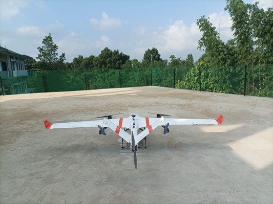
In the hilly state of Meghalaya, reaching remote health facilities has always been a logistical challenge. The rugged terrain and poor road network infrastructure have made it difficult to deliver medical supplies to these areas, and people have suffered as a result. To ensure access to quality healthcare for all, the government of Meghalaya through Meghalaya Health Systems Strengthening Project (MHSSP) initiated the innovative use of drones to address this issue. Drones are expected to provide a more efficient and effective means of transportation for medical commodities, including vaccines, medicines, diagnostic samples, blood units, and other supplies.
.png)
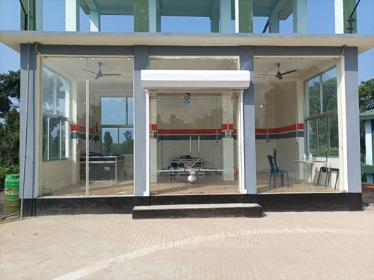
India's First Drone Station
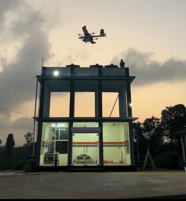
On 5th December 2022, the first of its kind drone station in India was unveiled at Jengjal Sub-divisional Hospital in West Garo Hills. This drone station will serve hard-to-reach health facilities within a 50 km radius, providing routine and emergency deliveries of medical supplies. Depending on demand, the number of flights expected per day will be between 5 to 8.
The government plans to scale up the project to cover all remote health facilities in the state by setting up similar drone stations at strategic locations that will integrate with the existing public health supply chain. This bold move aims to make healthcare accessible to every citizen of Meghalaya, regardless of their location.
.png)
Outcomes
- Extensive demonstration of the capability of the drone in terms of consistency, precision and delivery.
- Reduction in delivery time by 1/5th of the actual time needed. (3-4 hours by road reduced to 30 minutes one way)
- Demonstration of reverse logistics where Blood samples have been tested and reports shared within an hour of blood collection.
.png)
.png)
Spokes:
| Sl.No. | District | PHC/CHC Name |
|---|---|---|
| 1 | West Garo Hills | Pedaldoba PHC |
| 2 | South Garo Hills | Nangalbibra PHC |
| 3 | West Khasi Hills | Shallang PHC |
| 4 | East Garo Hills | Samanda PHC |
| 5 | North Garo Hills | Mendipathar PHC |
| 6 | West Garo Hills | Asanang PHC (Emergency LP) |
| 7 | West Garo Hills | Dadenggre CHC |
| 8 | East Garo Hills | Bansamgre PHC |
| 9 | East Garo Hills | Songsak PHC |
| 10 | North Garo Hills | Gabil PHC |
| 11 | North Garo Hills | Saulmeri PHC |
| 12 | North Garo Hills | Manikganj PHC |
| 13 | East Garo Hills | Dobu PHC |
Logistics data up to 7th September 2024::
|
MDDN Flight Data Summary |
|||
|
Number of flights taken |
Ariel distances covered (km) |
Payload transported (grams) |
Total airtime of aircraft (hh:mm:ss) |
|
515 |
16100.63 |
484,127 |
250:18:27 |
|
Last updated on 7th September 2024 |
|||


